


Murchison Falls marks one of the most physically commanding points along the entire course of the Nile. At this location, the river is compressed through a narrow rock cleft just seven metres wide and forced downward with enough force to fracture rock and shake nearby ground structures.
The drop measures roughly 43 metres. Impressive, yes, but the pressure: visible, tactile, and sustained, defines the experience more than its vertical scale. This is the Nile operating at maximum hydraulic force: direct, relentless, and unbroken.
Positioned at the northern edge of the Albertine Rift Valley, the falls connect Uganda’s central lakes to the lowlands bordering South Sudan and the Congo Basin. This junction has informed river navigation, defined national park boundaries, and shaped ecological patterns for over a century.
The surrounding park, Murchison Falls National Park, is Uganda’s largest. It holds expansive savannah, seasonal wetlands, and some of the highest mammal densities in East Africa.
But it is the falls themselves that anchor the entire system, influencing how water moves, where animals concentrate, and how humans interact with the landscape.
To approach Murchison Falls only as a visual attraction is to miss the scale of what takes place here. The site holds geological, ecological, and institutional relevance that extends well beyond its visible features.
The Nile Interrupted: Understanding the Falls
Murchison Falls occupies a precise point of transition in Uganda’s river geography. The Nile, having exited Lake Kyoga, broadens into the slow-moving Fajao Gorge stretch before narrowing dramatically at the Rift Valley escarpment.
Here, the river enters a faulted fracture between ancient crystalline rocks and drops 43 metres into a downstream channel leading to Lake Albert. This descent happens within a seven-metre-wide gap in the rock, an unusually narrow choke point for a river of such volume.
Geologically, the falls exist because of a sharp rift-boundary fault separating the Bunyoro escarpment from the Lake Albert graben. The exposed rock around the gorge is Precambrian in age: solid, heavily compacted, and resistant to erosion except at its fractured zones.
Water discharge at Murchison Falls varies seasonally between 300 and 1,200 cubic metres per second. The gradient and volume create conditions that maximise kinetic energy, forcing the river into high-velocity turbulence at the base.
The energy release is visual, yes, but it registers as sustained noise, pressure, and heat. The falls generate a standing mist column that modifies the immediate microclimate, supporting high-humidity plant growth on otherwise sun-exposed rock surfaces.
Downstream, sediment suspension patterns shift due to the sudden agitation, affecting the habitat composition for fish and aquatic invertebrates. The area also channels wind due to the lowland drop, making the gorge a spatial threshold for both air and water systems.
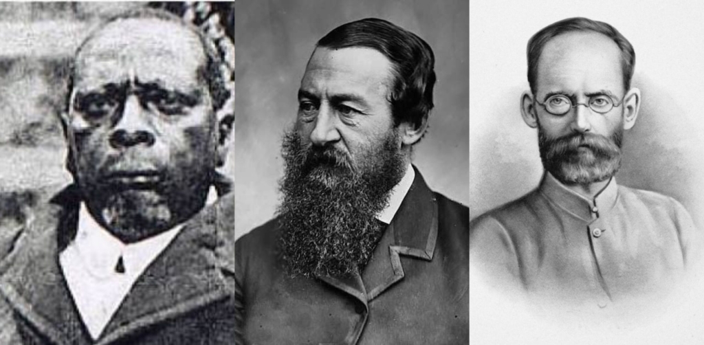
The name “Murchison” was applied in 1864 by British explorer Sir Samuel Baker, in honour of Roderick Murchison, then-president of the Royal Geographical Society.
Baker and his wife, Florence, reached the falls while mapping the Nile’s course westward toward Lake Albert. His journals describe the sound of the falls long before they were visible, characterising the site as a kind of rupture in the river’s logic.
History of Murchison Falls
Long before European cartographers entered the region, local communities living along the northern Rift Valley knew of the falls, though it was often contextualised in spiritual or territorial terms rather than mapped.
These oral understandings underscore that the falls were not “discovered” in the 19th century, but formally documented.
In 1864, British explorer Sir Samuel Baker and his wife, Florence, reached the site while tracing the Nile westward from Lake Kyoga. Baker named the falls after Roderick Murchison, then president of the Royal Geographical Society, reflecting a common imperial practice of assigning British names to natural landmarks.
The act of naming signalled possession, institutional approval, and formal geographic recognition.
Colonial Mapping and Park Establishment
Following Baker’s documentation, the falls became a focal point in British mapping of East Africa, particularly as they defined a key moment along the Nile’s journey toward the Albert Nile and eventually Egypt.
The area surrounding the falls was first designated as a game reserve in 1926 under colonial administration, primarily to regulate hunting by Europeans. In 1952, the reserve was upgraded to national park status under the Uganda National Parks Act. This formalisation came with improved infrastructure, including ranger stations, regulated access corridors, and early conservation research.
Murchison Falls, by this point, had become a fixed node in British colonial land-use policy.
Murchison Falls as a Political and Symbolic Site
During the mid-20th century, the falls entered public imagination beyond scientific and cartographic circles.
Winston Churchill referenced the falls in his 1908 travel writing as part of his vision of Uganda as the “pearl of Africa.” In the 1950s, American author Ernest Hemingway famously crash-landed nearby in two separate plane accidents, both of which elevated the site’s global intrigue.
Post-independence, under President Idi Amin in the 1970s, the government briefly renamed the park “Kabalega National Park” in honour of the Bunyoro king who had resisted British conquest. The name Murchison Falls, however, remained in common use.
The site has served, at different times, as an imperial trophy, a literary subject, and a symbol of post-colonial assertion.
Continuity, Memory, and Institutional Stewardship
Today, the falls remain under the protection of the Uganda Wildlife Authority (UWA), which manages the park’s ecological integrity, access protocols, and research partnerships.
While the historical name persists, the conversation around it has grown more nuanced. Interpretive signage, guide briefings, and local narratives increasingly include pre-colonial and post-independence histories.
Tourists encounter a place that is both preserved and evolving, one that reflects changing priorities in heritage, ecology, and national identity.
Murchison Falls National Park Today
Murchison Falls National Park covers approximately 3,893 square kilometres, positioned along the Victoria Nile in northwestern Uganda. It spans across four administrative districts: Buliisa, Nwoya, Kiryandongo, and Masindi
The river divides the park into two distinct ecological zones. The northern sector consists of open savannah grasslands and scattered acacia woodlands, while the southern zone is marked by thicker bush, forest patches, and a more undulating landscape.
The park stretches from Karuma in the east to the Albert Delta in the west. The river serves as the park’s central axis, shaping not only water flow but also wildlife distribution, accessibility, and spatial management.
Visitor access is arranged through several controlled entry points. Tangi Gate connects travellers from the Gulu direction into the northern sector, while Mubako and Bugungu gates provide access from the south and west.
A permanent road bridge at Paraa now links the northern and southern banks, replacing the older ferry system. This connection allows for uninterrupted road access between the sectors and has significantly improved ranger deployment, tourism logistics, and movement of supplies.
Management falls under the mandate of the Uganda Wildlife Authority. The park operates under a multiple-use conservation framework that combines ecological protection with regulated tourism and research.
Wildlife monitoring, anti-poaching patrols, fire line creation, and vegetation mapping are active components of daily operations. Community-based conservation programs are in place in the buffer zones, focusing on education, income alternatives, and conflict mitigation.
Murchison Falls continues to serve as the park’s symbolic and practical centre. The area around the falls holds ranger stations, research posts, accommodation, and monitoring points. The falls also provide a visual and acoustic marker that orients both staff and visitors across the vast expanse of the park.
Wildlife and Ecosystems
Murchison Falls National Park supports a structurally diverse set of ecosystems, shaped by hydrology, elevation, and soil conditions.
The northern sector is dominated by open savannah and acacia woodland, with Borassus palms scattered across the plains. South of the river, vegetation becomes denser, comprising Combretum thickets, riverine forest remnants, and mixed bushland.
Wetland systems concentrate around the Nile’s path and the Albert Delta, while the eastern escarpment holds seasonal streams and grass slopes.
The falls themselves sit at an ecological convergence point. They interrupt river flow, modify the surrounding climate, and create a narrow band of mist-influenced microhabitats. These conditions support plant species not found elsewhere in the park, including small ferns, algae colonies, and adapted mosses.
The area immediately below the falls remains difficult to survey due to constant turbulence.
a. Key Mammal Species and Distribution
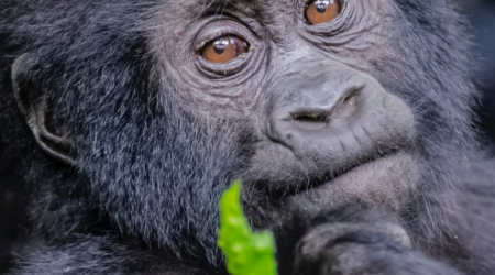
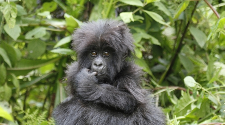
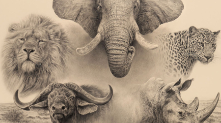
The park holds more than 70 species of mammals, with spatial ecology strongly influenced by proximity to the river.
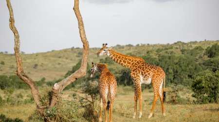
African elephants move between wooded zones and savannah plains, especially in dry seasons when permanent water becomes limited. Cape buffalo dominate in large herds, often seen in the northern plains. Uganda kob, Jackson’s hartebeest, oribi, and waterbuck occupy the open grasslands, while bushbuck and duiker remain in denser cover.
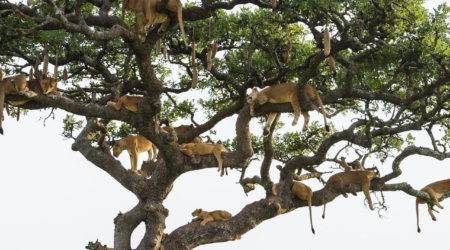
Predator presence is stable. Lions in the northern sector have adapted to hunting in open terrain, occasionally climbing fig trees for visibility. Leopards are more frequent along riverine corridors. Spotted hyenas are often heard before they are seen.
b. Birdlife and Ornithological Importance
Murchison Falls is one of Uganda’s top Important Bird Areas (IBAs), with over 450 recorded species.
Riverbanks, savannah, and delta zones support distinct avian communities. Shoebill stork can occasionally be seen in the Albert Delta, particularly during low water levels. The river also attracts African fish eagles, herons, and kingfishers, while the dry zones host Abyssinian ground hornbills, bee-eaters, and several sunbird species.
Migratory birds arrive seasonally, mostly from the Palearctic region, using the wetlands as stopover sites. Raptors such as martial eagles and bateleurs are present throughout the year.
c. Aquatic Ecology and River Dynamics
The Nile, as it passes through the park, hosts a robust aquatic system.
Fish species include Nile perch, tigerfish, catfish, and tilapia, sustaining both ecological balance and controlled fishing activities. Reptiles such as Nile crocodiles and monitor lizards are common along slow-moving stretches of the river. The riverbanks support papyrus, Vossia grass, and other flood-tolerant vegetation.
At the delta, nutrient deposition and sediment turbulence foster a biologically rich wetland zone. This area provides critical breeding habitat for amphibians and serves as a key feeding ground for birds and mammals.
Experiencing the Falls: Access, Viewpoints, and Activities
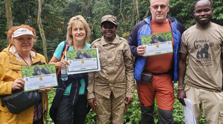
Visitors can access Murchison Falls through several official gates. From Kampala, the most used route enters via Kichumbanyobo Gate, approximately 305 kilometres northwest of the capital. This gate leads through the southern sector of the park, descending the escarpment into the core area near Paraa.
For travellers coming from Gulu or Pakwach, Tangi Gate on the northern side provides a direct link into the savannah zone. Bugungu Gate serves those approaching from Lake Albert or Hoima, although the escarpment road here is steep and seasonally sensitive.
The Paraa Bridge, constructed to replace the former ferry system, now links the park’s two sectors. Its completion has enabled uninterrupted ranger operations and better visitor flow.
Viewing Points: Top of the Falls vs. Bottom of the Falls
Two primary perspectives offer structured views of the falls: the top and the bottom.
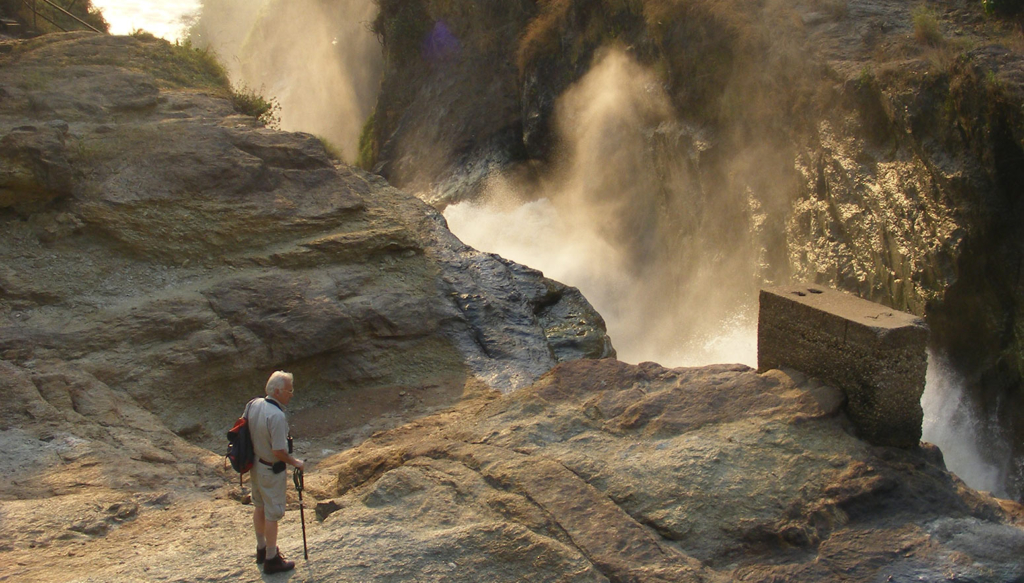
The top of the falls viewpoint is reached via a tarmac spur road branching west from the main Paraa route. A short hike leads visitors to the brink, where the Nile narrows to less than seven metres and drops 43 metres into the gorge below.
Barriers are installed at key vantage points, but spray and turbulence remain strong, especially during peak flow months.
The bottom of the falls is accessed by boat along the Victoria Nile. Visitors disembark at a ranger-controlled landing site just downstream from the plunge pool. From here, one can view the column of mist and hear the consistent roar that defines the gorge.
What to Expect on Site: Conditions, Timing, and Sensory Experience
At the top viewpoint, the sound is immediate and unbroken, a low-frequency rumble that intensifies with proximity.
During rainy seasons (March–May, August–November), spray increases and visibility can shift with wind. Dry months offer clearer views but stronger sun exposure. Footpaths are often wet and moss-lined; closed footwear is advisable.
Lighting changes significantly throughout the day. Early mornings reveal the mist backlit by the rising sun. Midday produces clearer photographic windows but harsher reflections. Late afternoons may limit colour contrast, though animal sightings often increase near the riverbanks.